A 60 km ribbon of green cross-border corridors, connecting areas for wildlife and rare species.
The most Southern Dutch region of Zuid Limburg is under pressure to maintain a balance: Nature, lush, rolling hills and the remarkable 2000 year history of a cultivated landscape. On the other hand the steady urban sprawl, the intensification of tourism and the need for expanding and optimizing infrastructure.
Studio Memo worked with Grontmij and Provincie Limburg as part of a think-tank to develop several scenarios and a strategy for combining these seemingly conflicting elements. Our work culminated in a cross-border proposal for reconnecting four delicate natural areas. These four zones were identified as key-components of a masterplan and were designated to become Green Corridors.
Each of the Green Corridors will undergo transformations in terms of connecting landscapes, transistioning farmland to wildlife area, extending recreational and nature trails, introducing fauna tunnels and wildlife bridges (ecoducts) and removing ecological high-impact facilities. These transformations will string together more than 60 km (37 ml) of uninterrupted wildlife area, running along the border and crossing back and forth between Germany and The Netherlands.
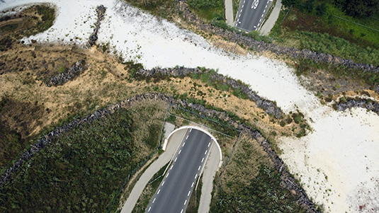
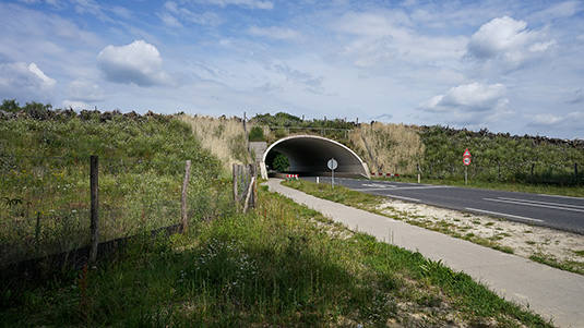
 The Green Corridors Wildlife Crossing ecoduct, viewed from the South-East.
 Various types of native terrain and vegetation come together at the ecoduct, providing a crossing-habitat for rare and endangered species.
During the following phase, Studio Memo’s work focused on Zone 4 : located at the rift between German natural preserve the Teverener Heide and the Dutch Brunssummerheide. The border area was physically closed, fenced and patrolled, up until 1993 following the Maastricht Treaty and the subsequent opening of borders between EU member states. The area also saw heavy industry: surface mining for high-purity sand (silica sand), there are two nearby NATO military bases, and waste management and landfill operations. Lastly, a large section of a regional ring road passes parallel between the two natural areas, creating an additional obstacle for wildlife.
Initial plans were developed to use the ecoduct as a catalyst for closing and revegetating the existing landfill. On the North-East, the ecoduct would connect to the slope of the already revegetated landfill, connecting it to the to-be-closed waste facility on the South-West side of the ring road. However, this strategy for Zone 4 has since developed to allow the active landfill and waste facility to stay operational until 2030.
The secondary strategy saw the ecoduct moved a few hundred meters North-West, along the axis of the ring road. It was redesigned to specifically focus on providing an overpass and extended habitat of dry and wet heather, shallow marshes and pools, white sand and raised bogs. This terrain is ideal for the rare and endangered ”Aardbok” -beetle (Dorcadion Fuliginator), the (non-toxic) Smooth Snake, the Sand Lizard and the Northern Crested Newt.
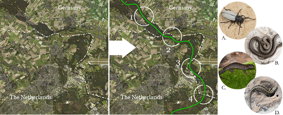 The four main Green Corridor -zones that will be connected to form one long (60 km / 37 ml) uninterrupted natural area: Tüdderner Fenn (Zone 1), Gangelt (Zone 2), Schinveld (Zone 3) and Brunssummer & Teverener Heide (Zone 4). The ecoduct on the Europaweg Noord in Zone 4 focusses on habitat for a rare and endangered type of longhorn beetle (the Grasboktor) (A), the Smooth Snake (B), the Northern Crested Newt (C), and the Sand Lizard (D). (Fauna pictures by Waarneming.nl )
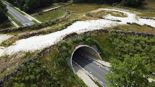
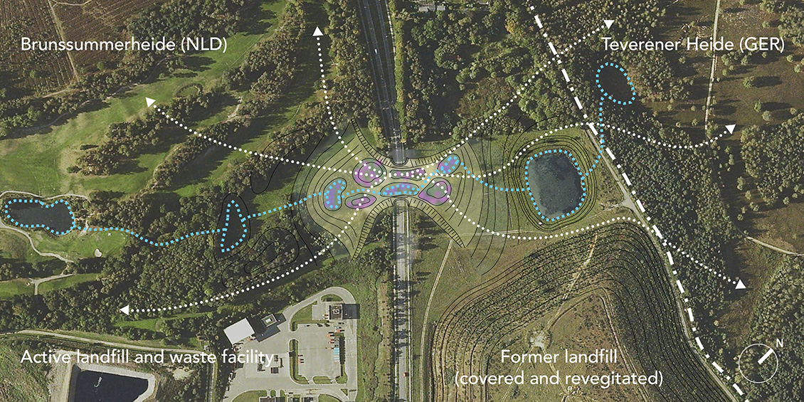 The ecoduct connects microhabitats of dry and wet heather, white sands and raised bogs. This allows rare and endangered species like the Sand Lizard that need open-terrain, to safely migrate across the ring road. The ecoduct also connects the German Teverenerheide and the Dutch Brunssummerheide, contributing to a unique 2.100 hectare (5,190 acre) purple heather natural preserve.
 The Green Corridors Wildlife Crossing ecoduct, viewed from the North-West.
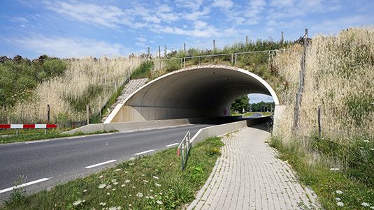
The ecoduct was designed and built using the BEBO concrete arch system. The arches were raised by placing them on concrete plinths. Dual bike lanes are separated from the main road with a concrete safety barrier. The ecoduct measures approximately 55 meters (60 yards) in length and it can be extended in the South-Eastern direction in the future, by adding additional arches.
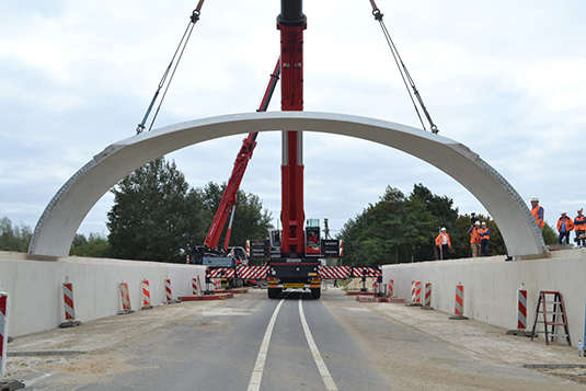 The placing of the first BEBO-arch by Ploegam and Mammoet.
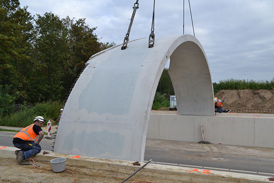 The placing of the first BEBO-arch by Ploegam and Mammoet.
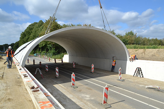 The arches are placed on a 2 meter (6.5 ft) plinth. (Picture by Ploegam.)
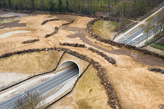 The ecoduct shortly after completion. (Picture by Martens Beton.)
 The ecoduct seen from the South-East, with first-year vegetation in full bloom.
 Aerial of the completed ecoduct.
 Early concept render for the ecoduct.
 Early concept render for the ecoduct.
 Early concept render for the ecoduct.
 Early concept render for the ecoduct.
Project: Green Corridors Wildlife Crossing
Client: Provincie Limburg & Grontmij N.V.
Location: Europaweg Noord, Landgraaf, The Netherlands
Type: Public / Infrastructure / Ecology
Size: 15.850 sqm / 3,9 acre
Status: Completed
Design: Arcadis / Ploegam / Grontmij / Studio Memo
General Contractor: Ploegam
Structural Engineer: Royal Haskoning DHV
Concrete BEBO Arch System: Martens Beton
Concrete Arch Production: Züblin A/S
Concrete Arch Assembly: Mammoet
Ecology Consultant: Natuurmonumenten
Regional Masterplan: Bureau Stroming / Studio Memo
Project Photography: ID Stijl / Ploegam / Martens Beton

